-
0–39
-
40–69
-
70–99
-
100–149
-
150–199
-
200–299

-
300–700
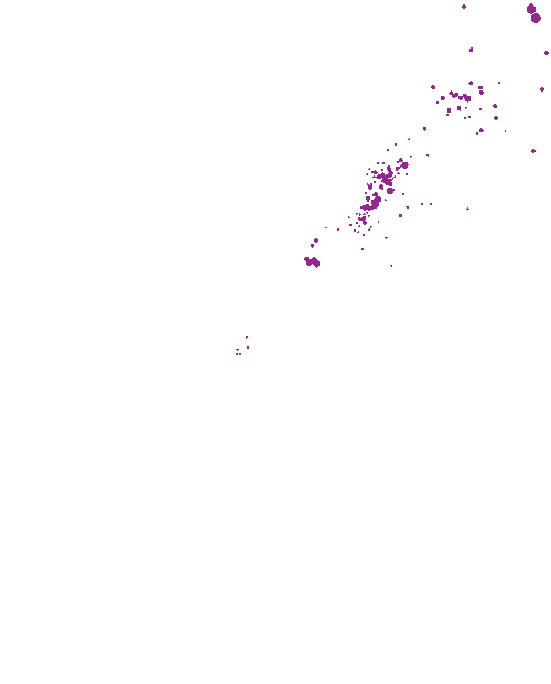
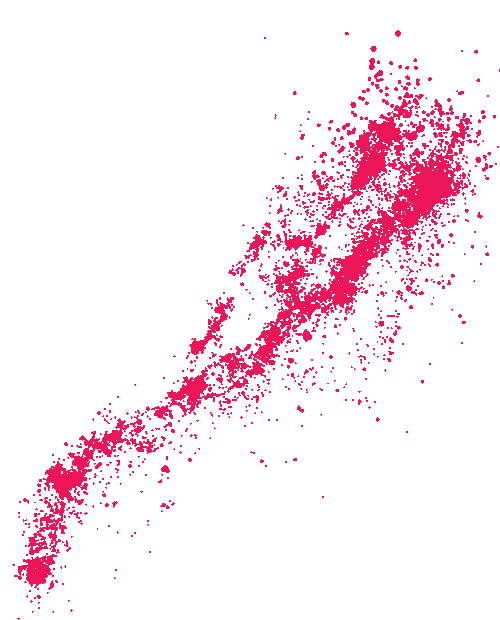
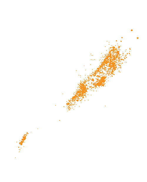
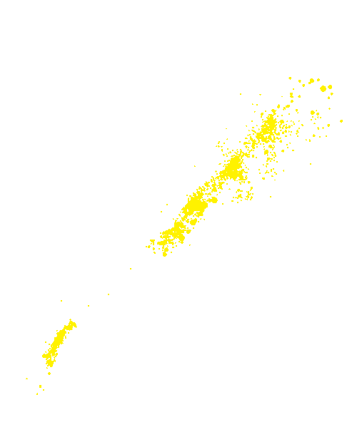
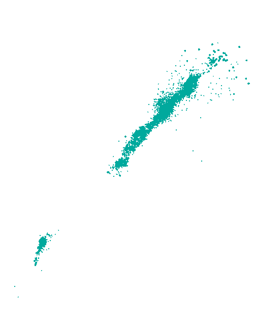
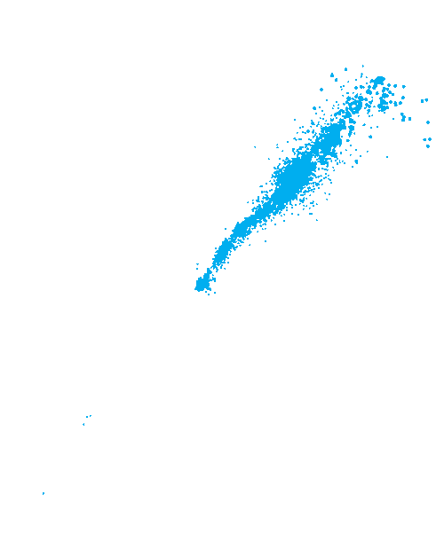
Earthquakes shake parts of New Zealand every day, although few are felt at the surface. This map shows all the earthquakes detected over a five-year period. Earthquakes are color-coded according to their depth, and it can be seen that clusters of quakes occur at different depths.
To access the latest data on New Zealand earthquakes use the GeoNet Quake Search catalogue.
Te whakamahi i tēnei tūemi
Te Ara - The Encyclopedia of New Zealand
This item has been provided for private study purposes (such as school projects, family and local history research) and any published reproduction (print or electronic) may infringe copyright law. It is the responsibility of the user of any material to obtain clearance from the copyright holder.