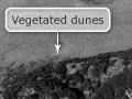
Dune lands are piles of wind-blown sand that build up behind beaches in exposed coastal areas. In earlier times, they were seen as wastelands – but today they are recognised as unique environments. Many are protected from development, and are being planted with native sand-binding plants such as pīngao (Desmoschoenus spiralis) and spinifex (Spinifex sericeus), which grow naturally on dunes close to the sea.
How dunes form
Dunes form where there is a good supply of sediment from the sea. Waves deposit sand on the beach, then when the tide retreats, the sand is exposed. Most sand grains are between 0.06 and 0.6 millimetres in diameter – small enough to be moved by the wind. The amount of sand moved increases exponentially with wind speed.
Sand gathers around small obstacles, forming a mound, which builds on itself and eventually becomes a dune. Sand also forms into ripples, which over time develop into ridges and dunes.
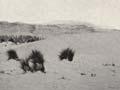
Active dune lands
Active dune lands are those where dunes are able to migrate, because they are not completely covered with vegetation and the wind can blow the sand about. Most former dune lands are covered in plants, and the dunes are no longer active.
Dune migration
Dunes have a shallow upwind slope and steeper downwind slope. Wind blows sand along the upwind slope, and then it tips down the steeper downwind slope. As a result, dunes migrate downwind over time. On the Manawatū coast, dune migration rates are some of the world’s highest. Maximum advance rates over one year have been measured as 1–10 metres through forest, 70 metres over low scrub, and 400 metres across grassland.
Remaining dune lands
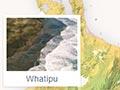
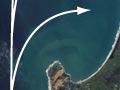
The larger remaining active dune lands are in Northland (Aupōuri Peninsula, North and South Kaipara peninsulas, Awhitū peninsula), Auckland’s west coast (Manukau Heads), Waikato (Aotea and Kāwhia harbours), the Manawatū coast, Farewell Spit, the Fiordland coast, Southland (Oreti Beach) and Stewart Island (Mason Bay). All are on west-facing coasts, where they are exposed to prevailing winds.
Less extensive dune lands are also found on eastern coasts – such as at Sandfly Bay on Otago Peninsula, and Woodend Beach near the Waimakariri River mouth. In the past, rare localised inland dunes also occurred in Central Otago, around Alexandra and Cromwell, formed from sand deposited by the Clutha River.
Many former dune lands have been taken over by native bush. This is a natural process – before human arrival, sand and vegetation vied for ascendancy in many exposed parts of coastal New Zealand.
Burning sands
In the 1880s in winter, settler families often made all-night watches for frostfish, which washed up on beaches north of Dunedin. One settler recalls: ‘[T]he boys used to set fire to the native grass, and night after night saw patches of the sandhills ablaze. In places the grass disappeared altogether, and at these points the strong north-east wind cut its way through, opening up long hollows through the protecting sandhills and carrying the sand over the flat in long, straight lines, or spreading it out fan-shaped.’ 1
Sand supply
The sand supply that forms dunes may be in a closed system where the sand was formed long ago, or an open system with ongoing inputs of new sand.
The giant dunes of the Aupōuri Peninsula in Northland are an open system. Much of their sand comes from the volcanoes of the central North Island. Over millions of years, sediment from volcanic eruptions has washed down the Waikato River. Coastal currents moved the sediment northwards, forming huge sand deposits, in a process that continues today. The Aupōuri Peninsula is actually a sand deposit (known as a tombolo) that joins the rocks of the mainland with those of Cape Rēinga.
Closed systems have little or no inputs of new sand. For instance, at Pākiri Beach on Auckland’s east coast, coastal erosion and storm waves shift sand from the beaches and dunes to sandbars out at sea. Between storms, smaller waves dump the sand back on the beaches.