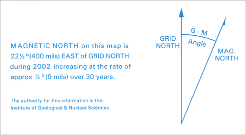
This diagram appears on most topographic maps to show magnetic declination (the difference in angle between grid north and magnetic north). This is the correction that needs to be applied to a magnetic compass reading, to find true north. Grid north runs very close to true north, but because flat maps do not accurately represent curved surfaces, grid north and true north are slightly apart.
Te whakamahi i tēnei tūemi
This item has been provided for private study purposes (such as school projects, family and local history research) and any published reproduction (print or electronic) may infringe copyright law. It is the responsibility of the user of any material to obtain clearance from the copyright holder.


Tukunga
The Grid Magnetic Angle
Richard Cullingworth (not verified)
11 o Hānuere 2011
Tāpiritia te tākupu hou