Kōrero: Manawatū and Horowhenua region

Early European settlement

Early European settlement

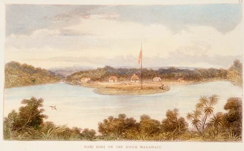
In 1847 Samuel Brees drew this picture of European houses on the Manawatū River, downstream from Moutoa. The buildings were for a survey party working in the district.

Te whakamahi i tēnei tūemi

Alexander Turnbull Library
Reference: A-109-029
Hand-coloured engraving after a drawing by Samuel Charles Brees

Permission of the Alexander Turnbull Library, National Library of New Zealand, Te Puna Mātauranga o Aotearoa, must be obtained before any re-use of this image.

Ngā whakaahua me ngā rauemi katoa o tēnei kōrero

Te tuhi tohutoro mō tēnei whārangi:

Malcolm McKinnon, 'Manawatū and Horowhenua region - Māori and European newcomers, 1820–1870', Te Ara - the Encyclopedia of New Zealand, http://www.TeAra.govt.nz/mi/artwork/9477/early-european-settlement (accessed 25 April 2024)

He kōrero nā Malcolm McKinnon, updated 1 Apr 2015