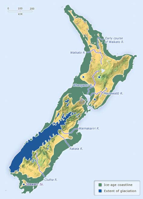
This map shows the glaciers and coastline of New Zealand during the latter part of the last glacial period, about 20,000–18,000 years ago. Sea level was about 100 metres lower than at present, so the shallower part of the continental shelf was exposed. Glacier ice was also more extensive, with several large glaciers reaching beyond the present West Coast of the South Island.
Using this item
Te Ara - The Encyclopedia of New Zealand
This item has been provided for private study purposes (such as school projects, family and local history research) and any published reproduction (print or electronic) may infringe copyright law. It is the responsibility of the user of any material to obtain clearance from the copyright holder.