
Kōrero: Gold and gold mining

Northburn tailings

Image
Northburn tailings

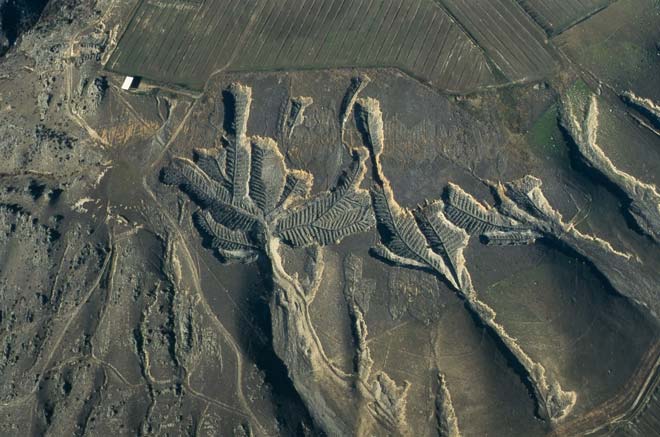
These distinctive scars are at Northburn on the shores of Lake Dunstan, Central Otago. The gravel terraces have been sluiced away and large boulders have been stacked in rows along waste-water channels to produce this fern-like pattern. Vineyards have been established nearby (upper right).

Te whakamahi i tēnei tūemi

Department of Conservation

by Kevin Jones

This item has been provided for private study purposes (such as school projects, family and local history research) and any published reproduction (print or electronic) may infringe copyright law. It is the responsibility of the user of any material to obtain clearance from the copyright holder.

Ngā whakaahua me ngā rauemi katoa o tēnei kōrero

Me pēnei te tohu i te whārang

Carl Walrond, Gold and gold mining – Dredging, Te Ara – the Encyclopedia of New Zealand, https://teara.govt.nz/mi/photograph/8630/northburn-tailings (accessed 4 June 2026).

He kōrero nā Carl Walrond, i tāngia i te 2 March 2009.

Comments

Gilbert van Reenen
31 October 2011
Its not actually vineyard showing at the top of the image as mentioned in your caption - those are border dykes which is a pasture irrigation system commonly used in Central Otago. There are vineyards nearby but some distance from the Herringbone Tailings - not alongside them.