Image
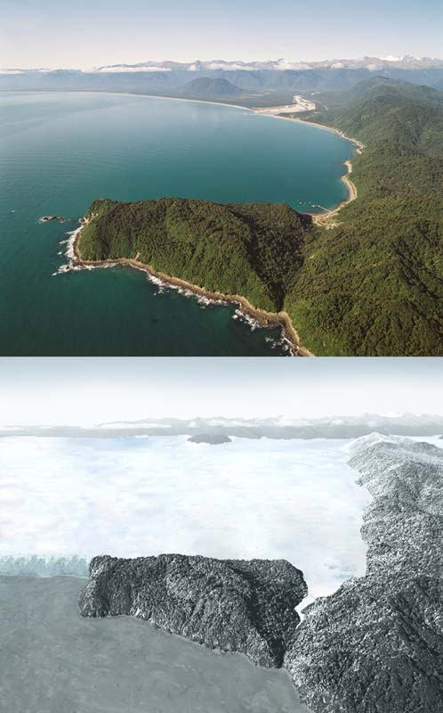
The top photograph is of Jackson Bay in South Westland, with Jackson Head in the foreground. The lower photograph shows how the same location might have looked about 14,000 years ago, near the end of the last ice age. Glacier ice extended down the main valleys, and coalesced to form an ice sheet. All the flat land was submerged by ice. Sea level was about 100 metres lower, so the coastline was further west than it is at present.
Te whakamahi i tēnei tūemi
Reference: CN26858/7
by Lloyd Homer
Source: G. Coates and S. Nathan, The Haast landscape. Lower Hutt: Institute of Geological & Nuclear Sciences, 1993.
Permission of GNS Science must be obtained before any use of this image.