Image
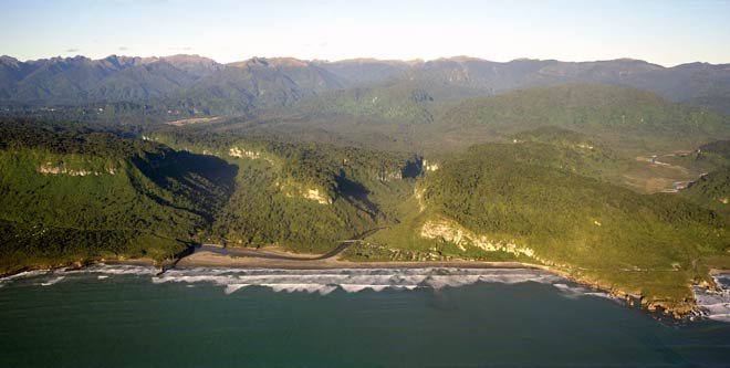
A single band of Oligocene limestone, about 50 metres thick, is responsible for many of the distinctive topographic features around Punakaiki, on the West Coast. Shown here, the limestone sheet slopes gently to the south. On the left side it caps the hills, and has been dissected to form cliffs on both sides of the Pororari River. Punakaiki township is squeezed between the cliffs, the sea, and the Pororari River. The limestone descends to sea level, and at the coast has eroded to form the distinctive Pancake Rocks (far right).
Te whakamahi i tēnei tūemi
Reference: CN36159
by Lloyd Homer
Permission of GNS Science must be obtained before any use of this image.