Image
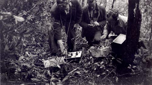
Geophysicists perform an electrical resistivity survey with a ratiometer in the Reefton area in 1937. This was part of a search for gold-bearing quartz reefs. From left: W. E. Hall, R. L. McHenry, and F. A. McNeill. This is possibly the earliest photograph of geophysical field work in New Zealand.
Te whakamahi i tēnei tūemi
Maxwell Gage
by Maxwell Gage
This item has been provided for private study purposes (such as school projects, family and local history research) and any published reproduction (print or electronic) may infringe copyright law. It is the responsibility of the user of any material to obtain clearance from the copyright holder.