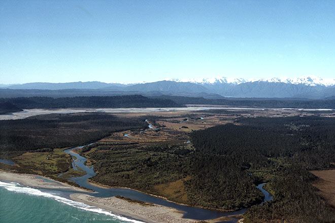
In south Westland, the Waitangiroto River (right) and Waitangitaona River (centre) flow into the Tasman Sea just south of the larger, glacier-fed Whataroa River. Floods change the course of these waterways from time to time, and their position in this view differs considerably from what Gerhard Mueller saw when he described the location of the colony in 1865–66. The tidal lagoon at the mouth is an ideal feeding ground for white herons, which breed in the tall forest a few hundred metres up the Waitangiroto River. A little further south is the much larger Ōkārito Lagoon, offering over 3,000 hectares of shallow water and tidal mudflats for foraging.
Te whakamahi i tēnei tūemi
Reference: 10053992
by Philippe Gerbeaux
This item has been provided for private study purposes (such as school projects, family and local history research) and any published reproduction (print or electronic) may infringe copyright law. It is the responsibility of the user of any material to obtain clearance from the copyright holder.