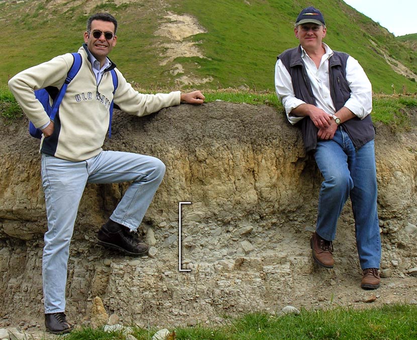
Tsunami scientists Marco Cisternas (left) and James Goff stand beside a buried layer of gravel and sand (marked) at Okourewa Stream, Palliser Bay. This is interpreted as a deposit from a past tsunami. The layer of angular pebbles and overlying sand is thought to be deposited by an advancing tsunami wave. It is overlain by younger river silt and sand.
Radiocarbon dating indicates that the tsunami layer was formed after 1350 CE, but the exact age cannot be determined.
Te whakamahi i tēnei tūemi
Private collection
by Bruce McFadgen
This item has been provided for private study purposes (such as school projects, family and local history research) and any published reproduction (print or electronic) may infringe copyright law. It is the responsibility of the user of any material to obtain clearance from the copyright holder.