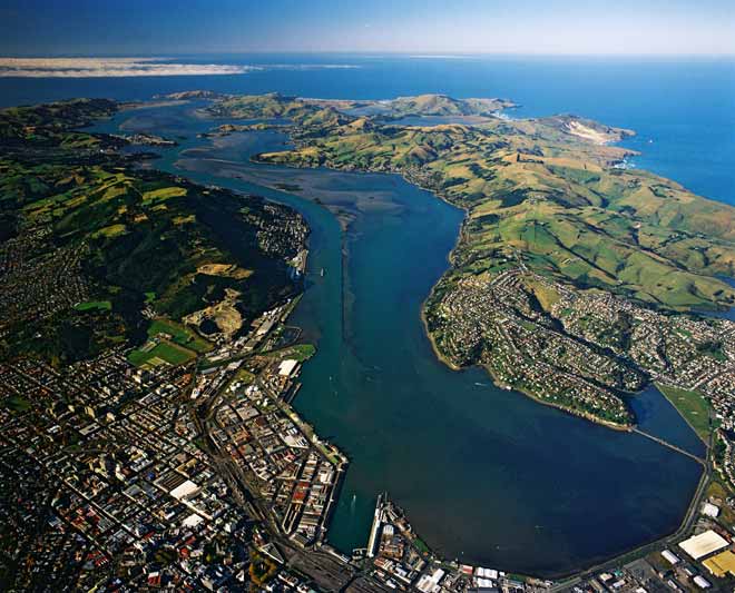
Over thousands of years, sand that swept up the southern coast of the South Island has linked the Otago Peninsula (right) to the city of Dunedin (left), making the Upper Harbour (city-end) shallower than the Lower Harbour (top left) near the entrance. European settlers faced a dilemma. Natural deep water ran out at Port Chalmers, but the only flat land suitable for building Dunedin city was at the shallow Upper Harbour end. So they built a shipping channel (hugging the left-hand shoreline). Victoria Channel, as it was called, opened in 1881 and has been deepened many times. Its eastern edge can be seen running down the harbour, a rock wall designed to keep the sand out. By the late 1960s over 90% of shipping used the Dunedin wharves, but the big container ships and bulk carriers of the 1970s favoured Port Chalmers.
Te whakamahi i tēnei tūemi
Reference: CN32086/19
by Lloyd Homer
Permission of GNS Science must be obtained before any use of this image.