Image
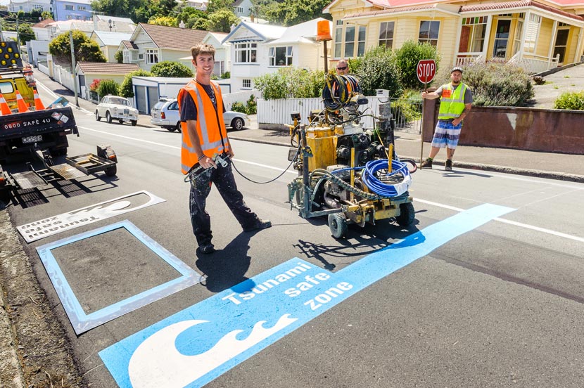
Workers mark blue lines on a street in the Wellington suburb of Island Bay to indicate a tsunami safe zone. Wellington City Council worked with local residents to develop the blue line concept, which has seen markers painted across streets near the city’s coastline at the maximum possible wave run-up heights. These lines are based on modelling by GNS Science and Greater Wellington Regional Council.
Te whakamahi i tēnei tūemi
by Mark Coote
This item has been provided for private study purposes (such as school projects, family and local history research) and any published reproduction (print or electronic) may infringe copyright law. It is the responsibility of the user of any material to obtain clearance from the copyright holder.