Image
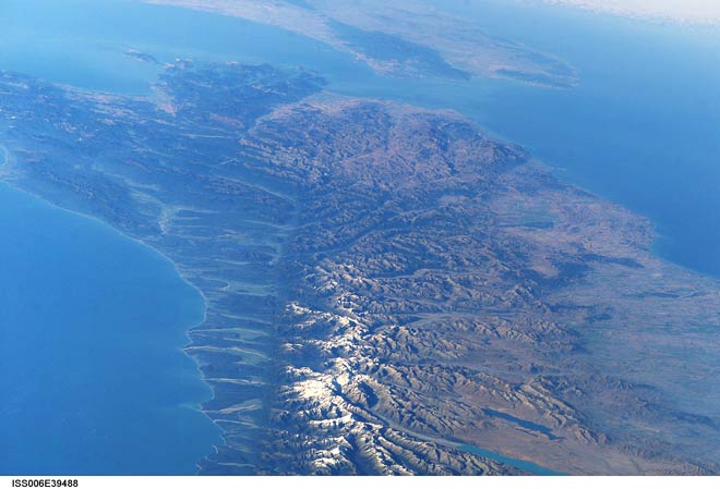
This view of the Alpine Fault shows how it cuts across the central South Island. The eastern side has been uplifted, forming the Southern Alps. All the major rivers on the West Coast start in the mountains and carry huge loads of sediment westwards, gradually building out the coastline.
Te whakamahi i tēnei tūemi
Reference: International Space Station Crew Earth Observations Experiment and the Image Science & Analysis Group, ISS006-E-39488
This item has been provided for private study purposes (such as school projects, family and local history research) and any published reproduction (print or electronic) may infringe copyright law. It is the responsibility of the user of any material to obtain clearance from the copyright holder.