
Kōrero: Active faults

Wellington Fault in the Hutt Valley

Image
Wellington Fault in the Hutt Valley

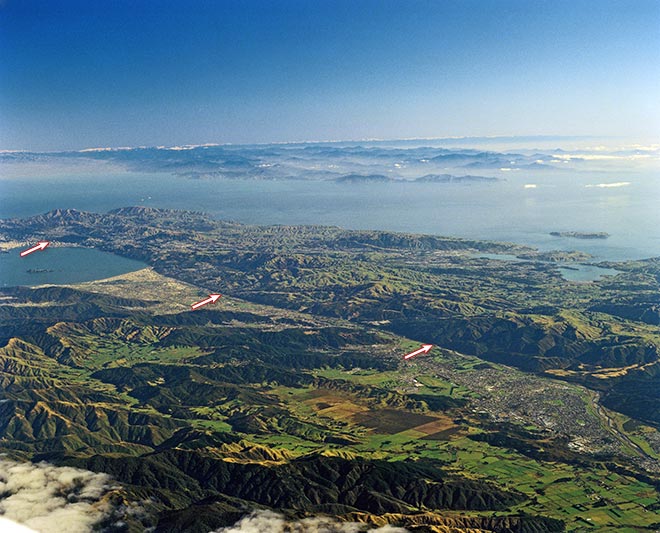
This view shows the Wellington Fault, which forms a sharp edge to the Hutt Valley, with Petone and Lower Hutt at centre left of the photograph. The eastern (nearer) side of the Wellington Fault has subsided, and has been filled with gravel from the Hutt River.

Te whakamahi i tēnei tūemi

GNS Science

Reference: CN20124/27

by Lloyd Homer

Permission of GNS Science must be obtained before any use of this image.

Ngā whakaahua me ngā rauemi katoa o tēnei kōrero

Me pēnei te tohu i te whārang

Eileen McSaveney, Active faults – New Zealand’s longest active faults, Te Ara – the Encyclopedia of New Zealand, https://teara.govt.nz/mi/photograph/4364/wellington-fault-in-the-hutt-valley (accessed 4 June 2026).

He kōrero nā Eileen McSaveney, i tāngia i te 2 March 2009.