Image
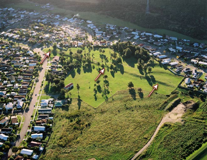
The most recent rupture on the Wellington Fault has formed a low, straight scarp across California Park, Upper Hutt. Subdivision of the land in the 1960s took account of the fault, and no houses were built directly across it. It forms the centre berm in California Drive (upper left). The position of the fault is marked with arrows.
Te whakamahi i tēnei tūemi
Reference: CN14444/10
by Lloyd Homer
Permission of GNS Science must be obtained before any use of this image.