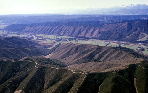
The Moutere Depression is the term geologists use to describe the lower-lying land between the Richmond Range in the east and the Arthur Range in the west. This depression has been filled by ancient clay-bound gravels known as Moutere gravels, which have eroded into low hills. The Upper Moutere and Mahana areas are noted for these gravels, but they extend far inland, as can be seen in this aerial photograph of the middle reaches of the Motueka River. As they form poor soils, many of the hills have been planted in exotic forest rather than farmed. The uniformity of the underlying geology has resulted in a distinctive ‘herringbone’ drainage pattern.
Te whakamahi i tēnei tūemi
New Zealand Society of Soil Science
Reference: Les Molloy, Soils in the New Zealand landscape: the living mantle. Wellington: Mallinson Rendel, 1988, plate 8.10
by Quentin Christie
This item has been provided for private study purposes (such as school projects, family and local history research) and any published reproduction (print or electronic) may infringe copyright law. It is the responsibility of the user of any material to obtain clearance from the copyright holder.