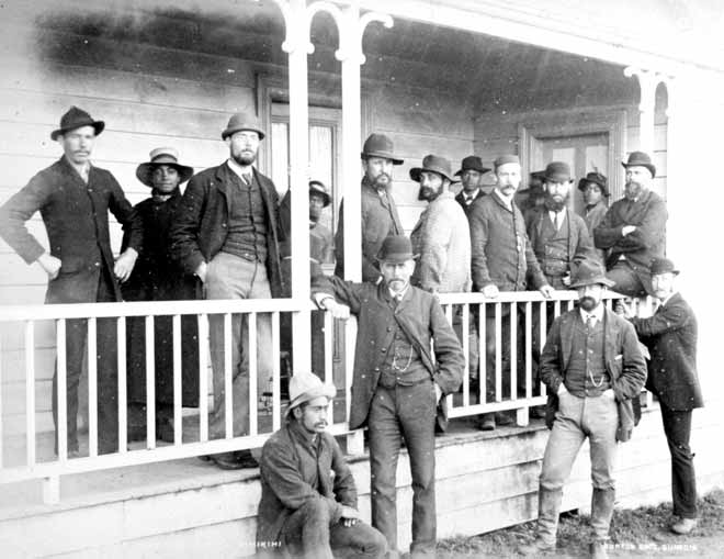
Surveyor and engineer John Rochfort (in bowler hat and watch chain, centre) stands alongside surveyors and their offsiders who worked on the North Island main trunk line. Rochfort helped map New Zealand, opening it up for European settlement. Trained in England by Isambard Kingdom Brunel, the famous 19th-century engineer, Rochfort explored the headwaters of the Hurunui, Taramakau and Buller rivers, discovered gold in the Buller and coal in Denniston, laid out Greymouth and charted the route for the Rimutaka railway line. He surveyed the Buller Gorge railway, and led the engineering reconnaissance of the North Island main trunk line, against sustained opposition from local Māori.
Te whakamahi i tēnei tūemi
Canterbury Museum, Brassington Collection
Reference: 1956.147.5
by Burton Brothers
Permission of Canterbury Museum, Rolleston Avenue, Christchurch, New Zealand must be obtained before any re-use of this image.