Image
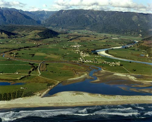
The fertile river flats of the Karamea valley provided good farmland for the early settlers in the 1870s. The present urban area, in the centre of the photograph, consists of two settlements along the main road: Karamea closest to the coast and Market Cross further away.
Te whakamahi i tēnei tūemi
Reference: 1757/16
by Lloyd Homer
Permission of GNS Science must be obtained before any use of this image.