Image
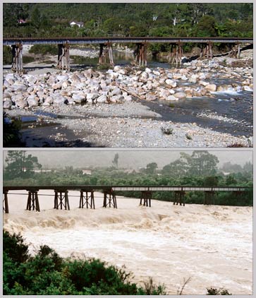
Usually the Waimangaroa River, 17 kilometres north-east of Westport on the West Coast of the South Island, is a placid stream. But after a few hours of heavy rain it becomes a raging torrent. Many South Island rivers, fed by rainfall in the mountains, are prone to flash floods.
Te whakamahi i tēnei tūemi
Private collection
by Stuart Henley (top); Simon Nathan (bottom)
This item has been provided for private study purposes (such as school projects, family and local history research) and any published reproduction (print or electronic) may infringe copyright law. It is the responsibility of the user of any material to obtain clearance from the copyright holder.
Comments
04 April 2012