Image
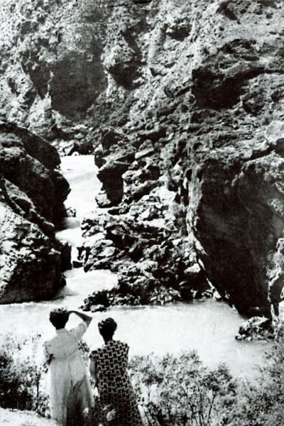
On his journey north in 1853 with the chief Reko, Nathanael Chalmers used this rock bridge to cross the Kawarau River. The bridge was where the banks narrowed to about 2 metres and could be jumped, although the span has since been widened by floods.
Te whakamahi i tēnei tūemi
Cromwell & Districts Museum
This item has been provided for private study purposes (such as school projects, family and local history research) and any published reproduction (print or electronic) may infringe copyright law. It is the responsibility of the user of any material to obtain clearance from the copyright holder.