Image
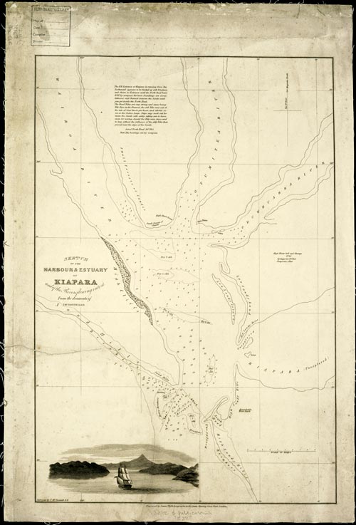
This chart was prepared from an initial survey by Thomas McDonnell, probably in 1836, and engraved by James Wyld (geographer to the Queen) in 1837 for presentation to the Governor of New South Wales. Kaipara is misspelt as ‘Kiapara’.
Te whakamahi i tēnei tūemi
Reference: MapColl-832.1aj/1836?/565
Permission of the Alexander Turnbull Library, National Library of New Zealand, Te Puna Mātauranga o Aotearoa, must be obtained before any re-use of this image.