
Kōrero: Geology – overview

New Zealand region 10 million years ago

Image
New Zealand region 10 million years ago

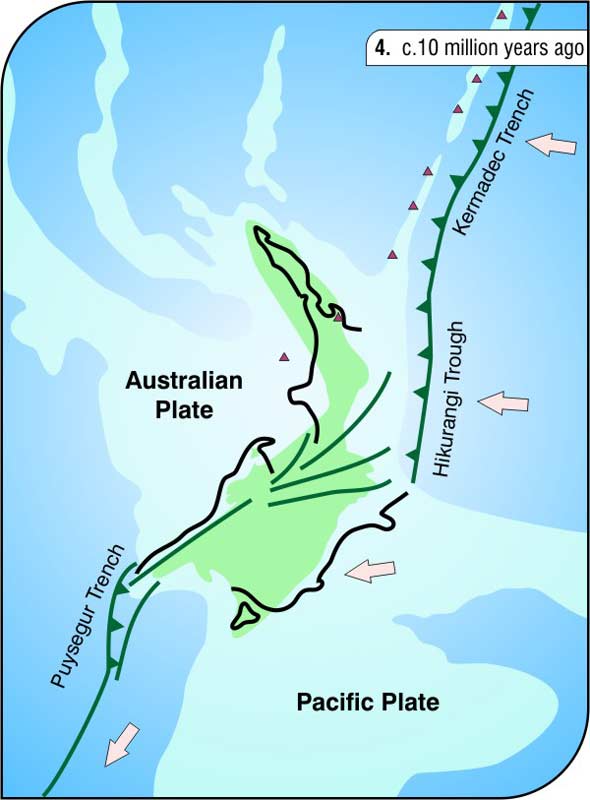
This is a reconstruction of the New Zealand region about 10 million years ago. The green area represents land. The major tectonic features we recognise today had formed, including the Alpine Fault in the South Island and the subduction zone, where the ocean floor is descending beneath the North Island.

Te whakamahi i tēnei tūemi

GNS Science

Reference: E. McSaveney and R. Sutherland, New Zealand adrift. 2nd ed. Lower Hutt: Institute of Geological & Nuclear Sciences, 2005

Permission of GNS Science must be obtained before any use of this image.

Ngā whakaahua me ngā rauemi katoa o tēnei kōrero

Me pēnei te tohu i te whārang

Eileen McSaveney rāua ko Simon Nathan, Geology – overview – New Zealand reborn, Te Ara – the Encyclopedia of New Zealand, https://teara.govt.nz/mi/map/8378/new-zealand-region-10-million-years-ago (accessed 25 June 2026).

He kōrero nā Eileen McSaveney rāua ko Simon Nathan, i tāngia i te 2 March 2009.

Comments

George Losey
09 July 2013
What do the heavy black lines in these reconstructions refer to? Vry useful site!