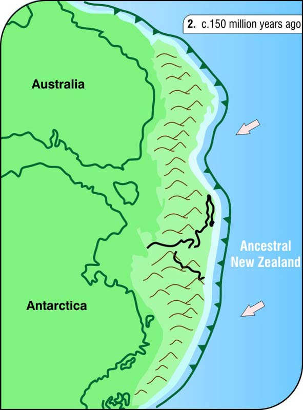
The rocks that underlie much of New Zealand were formed beneath the oceans between 300 and 150 million years ago. Sediments eroded from the Gondwana supercontinent were carried by rivers to the sea and deposited offshore, while volcanic activity built up oceanic islands. The diagram is a paleogeographic map – a reconstruction of the geography about 150 million years ago. By this time, the rocks that had built up offshore had been plastered onto the edge of Gondwana and uplifted, forming a mountainous region.
Te whakamahi i tēnei tūemi
Reference: E. McSaveney and R. Sutherland, New Zealand adrift. 2nd ed. Lower Hutt: Institute of Geological & Nuclear Sciences, 2005
Permission of GNS Science must be obtained before any use of this image.