Kōrero: Coal and coal mining

Geology of Island Block

Image
Geology of Island Block

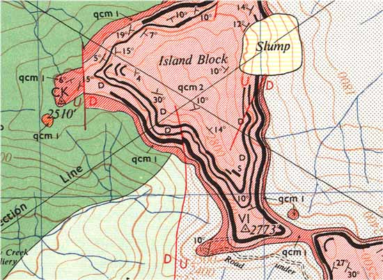
This is a detailed geological map of Island Block at Garvey Creek, near Reefton. The colours indicate different rock types. Brunner coal measures, containing thick coal seams, are pink. Individual coal seams are shown in black. These have been traced out in steep, heavily bush-covered country by prospectors.

Te whakamahi i tēnei tūemi

GNS Science

Permission of GNS Science must be obtained before any use of this image.

Ngā whakaahua me ngā rauemi katoa o tēnei kōrero

Me pēnei te tohu i te whārang

Alan Sherwood rāua ko Jock Phillips, Coal and coal mining – Coal resources, Te Ara – the Encyclopedia of New Zealand, https://teara.govt.nz/mi/map/7412/geology-of-island-block (accessed 15 July 2026).

He kōrero nā Alan Sherwood rāua ko Jock Phillips, i tāngia i te 2 March 2009.