Image
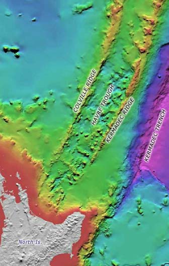
The deep, rough seabed of the Havre Trough lies between the Colville and Kermadec ridges. This area, where the earth’s crust is being stretched apart, continues onshore at the Bay of Plenty into the Taupō Volcanic Zone. The Havre Trough is opening up, moving the Kermadec Ridge with its many active conical volcanoes, eastwards away from the Colville Ridge with its extinct ones.
Te whakamahi i tēnei tūemi
Te Ara - The Encyclopedia of New Zealand
Source: NIWA – National Institute of Water and Atmospheric Research
This item has been provided for private study purposes (such as school projects, family and local history research) and any published reproduction (print or electronic) may infringe copyright law. It is the responsibility of the user of any material to obtain clearance from the copyright holder.