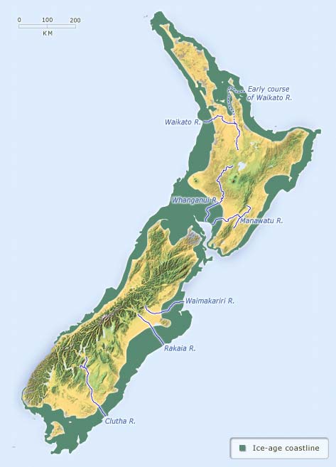
In the last major glacial period some 20,000 years ago, New Zealand’s land area was much larger, as the sea was 120–30 metres lower than its present level. The three main islands were joined together as a single island. During this period, rivers such as the Clutha, Rakaia and Waimakariri carried huge loads of sediment all the way to the edge of the continental shelf. The Waikato River (dashed line) originally flowed north and entered the sea on the eastern side of the North Island. About 20,000 years ago it changed to its present course.
Te whakamahi i tēnei tūemi
Te Ara - The Encyclopedia of New Zealand
Source: GNS Science
This item has been provided for private study purposes (such as school projects, family and local history research) and any published reproduction (print or electronic) may infringe copyright law. It is the responsibility of the user of any material to obtain clearance from the copyright holder.