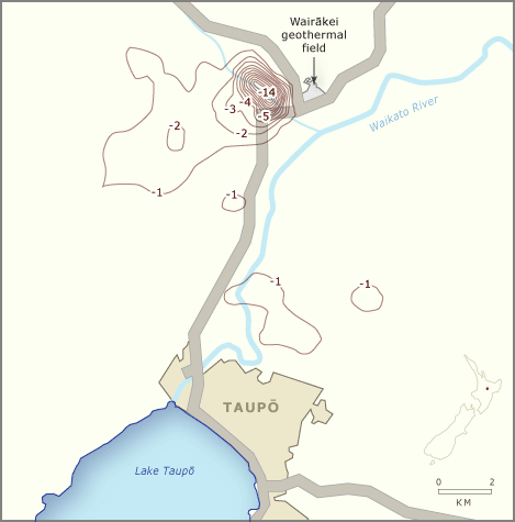
Extracting steam at Wairākei has caused the ground to subside. This map shows the total subsidence, measured over almost 50 years, from 1953 to 2001. The contour interval is 1 metre. The greatest subsidence, up to 14 metres, is in the immediate area of the borefield. A larger area has subsided by over a metre, indicating that extraction of geothermal fluid may affect a large area in the long term.
Te whakamahi i tēnei tūemi
Te Ara - The Encyclopedia of New Zealand
Source: Contact Energy
This item has been provided for private study purposes (such as school projects, family and local history research) and any published reproduction (print or electronic) may infringe copyright law. It is the responsibility of the user of any material to obtain clearance from the copyright holder.