Image
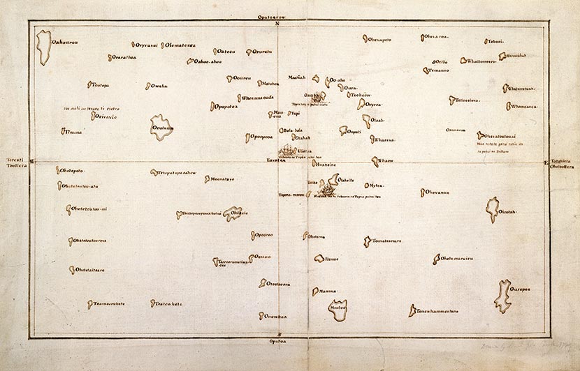
Tupaia’s chart from 1769 is evidence of the intricacy and detail of Polynesian knowledge of the South Pacific, and a striking contrast to the emptiness of the same space in European maps of the time.
Te whakamahi i tēnei tūemi
Reference: ADD MS 21593c
This item has been provided for private study purposes (such as school projects, family and local history research) and any published reproduction (print or electronic) may infringe copyright law. It is the responsibility of the user of any material to obtain clearance from the copyright holder.