Image
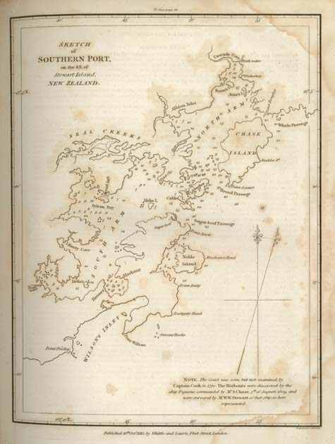
William Stewart, the first mate aboard the Pegasus – and after whom Stewart Island was named – made this chart of Port Pegasus which he called Southern Port, in 1809. The Pegasus spent several weeks under repair in the harbour, giving Stewart time to complete his chart. Port Pegasus/Pikihatiti is the second-largest inlet on the island, after Paterson Inlet/Whaka ā Te Wera.
Te whakamahi i tēnei tūemi
Hocken Collections, University of Otago
Permission of the Hocken Collections Uare Taoka o Hakena, University of Otago, must be obtained before any re-use of this image. Further information may be obtained from the Library through its website.