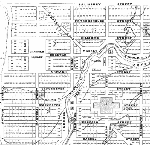
The predominance of English names in the original plot map of Christchurch is clear. The names were primarily drawn from Anglican bishoprics, but Lyttelton, being the first place of settlement, got the higher-class names. Sumner, the second settlement, received the next best. Christchurch city had to be content with those left, which explains why names of more distant bishoprics such as Tuam (from Ireland) and Madras (from India) sit alongside English names such as Salisbury, Chester, Hereford, Oxford and Cambridge.
Te whakamahi i tēnei tūemi
Reference: CMU1559/2
Permission of Canterbury Museum, Rolleston Avenue, Christchurch, New Zealand must be obtained before any re-use of this image.