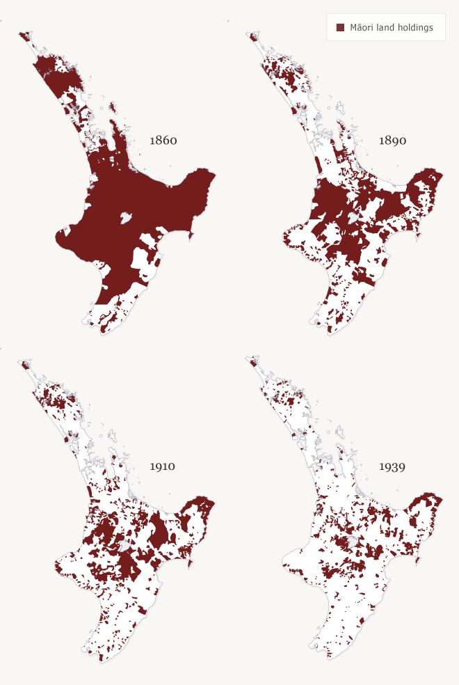
These maps show the progressive transfer of Māori land in the North Island to either government or private European ownership. In the early 1860s, most of the South Island had been sold, but most North Island land remained under Māori control. European ownership had advanced substantially only in Wairarapa, Hawke’s Bay and Auckland. Over the next 30 years, as confiscations and the impact of the Māori Land Court took effect, Māori lost land throughout the island. By 1910 only East Coast and the centre of the North Island had substantial Māori land holdings. By 1939 even these isolated patches had been further reduced.
Te whakamahi i tēnei tūemi
Te Ara - The Encyclopedia of New Zealand
Source: Claudia Orange, Illustrated history of the Treaty of Waitangi. Wellington: Bridget Williams Books, 2001, pp. 318-319
This item has been provided for private study purposes (such as school projects, family and local history research) and any published reproduction (print or electronic) may infringe copyright law. It is the responsibility of the user of any material to obtain clearance from the copyright holder.
Comments
27 November 2014