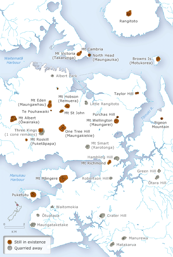
During his visit to New Zealand in 1858–59, geologist Ferdinand Hochstetter prepared a detailed map of the volcanic cones and lava flows around Auckland, incorporating information supplied by Charles Heaphy. Aggregate from cones and lava flows was prized for roads, footpaths and other construction projects. Many cones were quarried away, with major changes to the landscape. The overlay to the map illustrates the extent of the quarrying over 140 years.
Te whakamahi i tēnei tūemi
Te Ara - The Encyclopedia of New Zealand
This item has been provided for private study purposes (such as school projects, family and local history research) and any published reproduction (print or electronic) may infringe copyright law. It is the responsibility of the user of any material to obtain clearance from the copyright holder.