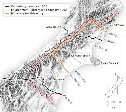
The Canterbury region as defined in this entry consists of north and mid-Canterbury, Christchurch and Banks Peninsula. The regional council, Environment Canterbury, also takes in South Canterbury and Kaikōura. The Canterbury Province of 1853 included an even wider area: it stretched to the West Coast, and encompassed the area between the Waitaki and Hurunui rivers.
Te whakamahi i tēnei tūemi
Te Ara – The Encyclopedia of New Zealand
This item has been provided for private study purposes (such as school projects, family and local history research) and any published reproduction (print or electronic) may infringe copyright law. It is the responsibility of the user of any material to obtain clearance from the copyright holder.