-
Walking tracks

-
Landforms

-
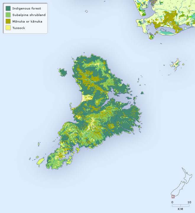
Vegetation
-
Place names

Stewart Island is a mountainous island, with a valley, Mason Bay in the west to the coast in the east, separating the northern from southern ranges. A large section of the island is part of Rakiura National Park. There are many walking tracks in the area north and west of Halfmoon Bay (Oban). Most of the indigenous vegetation remains. Click on the legend of this map to examine the land forms, the walking tracks and the vegetation.
Te whakamahi i tēnei tūemi
Te Ara - The Encyclopedia of New Zealand
This item has been provided for private study purposes (such as school projects, family and local history research) and any published reproduction (print or electronic) may infringe copyright law. It is the responsibility of the user of any material to obtain clearance from the copyright holder.