-
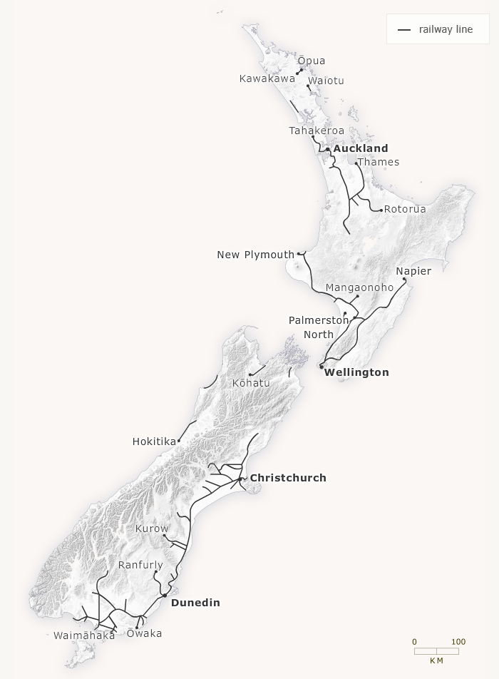
1880

-
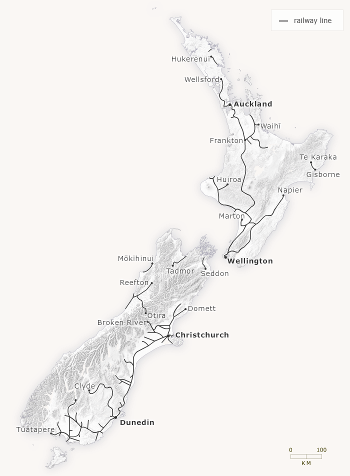
1890

-
1900
-
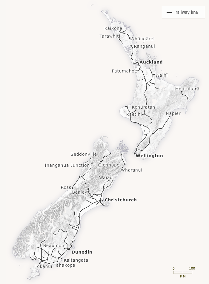
1910
-
1920
-
1933
-
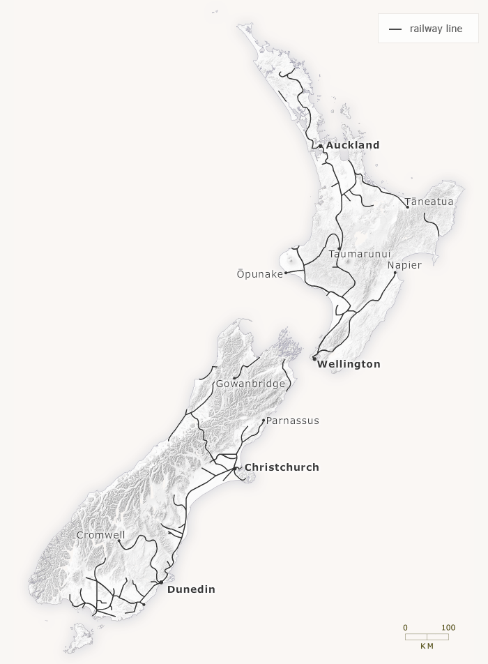
1940
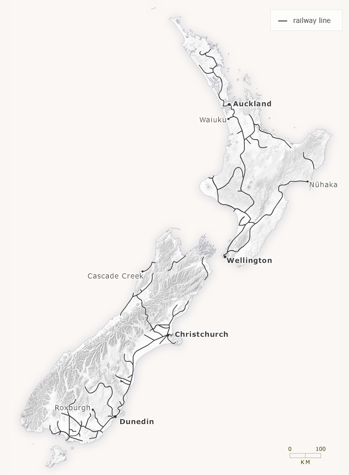
This map shows New Zealand’s rail network between 1880 and 1940. The length of the network peaked at more than 5,500 kilometres in 1953. From the late 1950s branch lines closed, and by the 2000s, there were less than 4,000 kilometres of railway lines.
Te whakamahi i tēnei tūemi
Te Ara - The Encyclopedia of New Zealand
This item has been provided for private study purposes (such as school projects, family and local history research) and any published reproduction (print or electronic) may infringe copyright law. It is the responsibility of the user of any material to obtain clearance from the copyright holder.
Comments
31 October 2023