
Story: Bay of Plenty places

Mayor Island

Image
Mayor Island

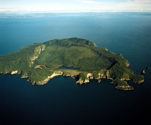
The crater of Mayor Island (Tūhua) shows up clearly in this view from the east, with the Bay of Plenty coastline in the distance. The last eruption, around 7,000 years ago, left the crater with a rim breached nearly to sea level on the east side of the island (foreground).

Using this item

GNS Science

Reference: CN9167/9

by Lloyd Homer

Permission of GNS Science must be obtained before any use of this image.

All images & media in this story

How to cite this page

Malcolm McKinnon, Bay of Plenty places – Inshore islands, Te Ara – the Encyclopedia of New Zealand, https://teara.govt.nz/en/photograph/5663/mayor-island (accessed 4 June 2026).

Story by Malcolm McKinnon, published 2 March 2009, updated 1 July 2015.

Comments

Steve Locke
02 July 2010
Fantastic picture of Mayor Island.