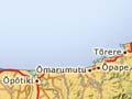
Tōrere
Coastal settlement 23 km north-east of Ōpōtiki on State Highway 35.
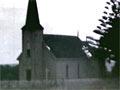
It is a centre for the Ngāi Tai people. They have connections to the Tainui tribes through Tōrere, the daughter of Hoturoa, commander of the Tainui canoe. Their lands, however, lie between those of two Mataatua tribes, Te Whakatōhea and Te Whānau-ā-Apanui. A finely decorated church is a feature of the settlement.
Te Kaha
Coastal settlement 70 km north-east of Ōpōtiki on State Highway 35, and principal settlement for the Te Whānau-ā-Apanui people. An office of Te Whānau-ā-Apanui is located in the township. In 2013 the population was 387.
Through much of the 19th and into the 20th century Te Kaha was a centre for whaling. In more recent times there has been farming, and the settlement is also a holiday destination.
Raukōkore
Farming locality on Papatea Bay, just north of the mouth of the Raukōkore River and 97 km north-east of Ōpōtiki on State Highway 35.
On the promontory facing each other are Anglican and Catholic churches. The entrance to the latter was once marked by a huge whalebone arch, a relic of old whaling days. The arch is now in the Whakatāne Museum.
Whangaparāoa
Coastal settlement 118 km from Ōpōtiki on State Highway 35.
Whangaparāoa is one of the most historic sites in the Bay of Plenty. It is where the twin canoes, Te Arawa and Tainui, made landfall on Te Ika-a-Māui (the North Island), before heading to other shores. (Some accounts suggest this was after first landing further north.)
The voyagers saw what they thought were kura (red feathers) on shore – almost certainly the summer-flowering pōhutukawa. This suggests that the landfall occurred in November or December. Navigation research indicates that this is the most favourable time for sailing from tropical latitudes.
Tihirau
Prominence rising above Whangaparāoa. The landmark sets the eastern boundary of the rāhui (prohibition) imposed generations ago by Muriwai, sister of Toroa, the captain of the Mataatua canoe, when two of her children drowned.
Cape Runaway
Easternmost promontory of the Bay of Plenty. In 2013 the population for the Cape Runaway district was 1,146.
It was named Cape Runaway by James Cook after an incident on 31 October 1769:
At 9 Five Canoes came off to us, in one of which was were upwards of 40 Men all Arm'd with Pikes &Ca ... I order'd a grape shot to be fired a little wide of them. This made them pull off a little ... I order'd a round shot to be fired over their heads which frightend them to that degree that I believe they did not think them selves safe untill they got a shore, this occasion'd our calling the point of land off which this Happen'd Cape Runaway. 1