Image
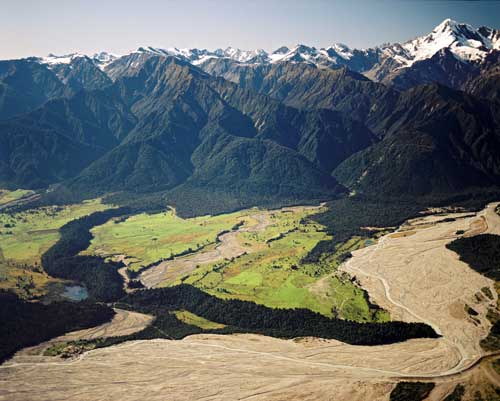
The Waiho Loop (centre) is a tree-covered semicircle of moraine or rocky debris about 80 metres high. It is known as a terminal moraine – a ridge that forms at the front of a glacier and remains after the glacier retreats. The ‘loop’ indicates the extent of the Franz Josef Glacier, about 12,000 years ago. Unlike the surrounding river flats, it was too rugged to be cleared for farming and remains covered in native forest. The braided Waiho River is at right.
Using this item
Reference: CN6517/17
by Lloyd Homer
Permission of GNS Science must be obtained before any use of this image.