Image
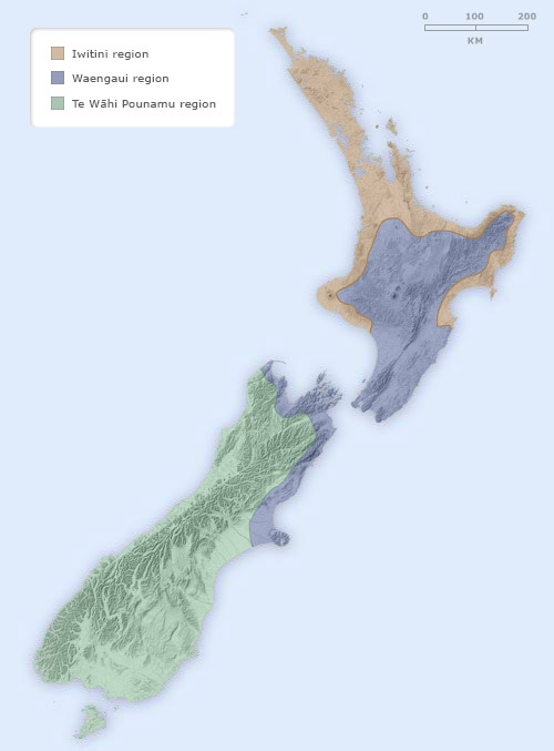
This map shows the region called Waenganui (the middle) by scholars. Around 15% of the Māori population lived there when Europeans arrived. Only limited horticulture using Polynesian cultigens was possible in this area.
Using this item
Te Ara - The Encyclopedia of New Zealand
Source: Janet Davidson, The prehistory of New Zealand. Auckland: Longman Paul, 1987, p. 34
This item has been provided for private study purposes (such as school projects, family and local history research) and any published reproduction (print or electronic) may infringe copyright law. It is the responsibility of the user of any material to obtain clearance from the copyright holder.