Darwin and landscape evolution
Charles Darwin’s theory of biological evolution, introduced in his 1859 book Origin of species, influenced earth scientists. It contributed to the idea that landscapes gradually evolved from one form to another.
William Morris Davis’s cycle of erosion
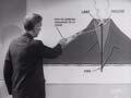
In 1884 an American geomorphologist, William Morris Davis, proposed a ‘cycle of erosion’ – all landscapes were formed when blocks of land were rapidly uplifted and then eroded, in a sequence of stages: youth, maturity and old age. Normal erosion was the work of rain and rivers, but in other places wind and sea could be the main agents. Volcanoes and glaciers also had an impact. It took millions of years of tectonic and climatic stability for a cycle of erosion to pass through all its stages. In old age, the landscape had worn down to a peneplain – almost flat, with an elevation near sea level.
Charles Cotton
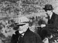
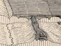
Davis came to New Zealand in 1914, and his ideas influenced a number of earth scientists. In particular Charles Cotton, geology lecturer at Victoria University College in Wellington, found Davis’s cycle of erosion useful for interpreting the development of the New Zealand landscape. Like Davis, Cotton used diagrams to show a progression of the land from youth, through maturity to old age.
Cotton’s ideas came together in his first and most influential book, The geomorphology of New Zealand (1922), which was revised and reprinted many times in the 50 years following its publication. He wrote several more books, including Volcanoes and landscape forms (1944).
Cotton and McCahon
Charles Cotton’s carefully illustrated books influenced many earth scientists, and a few artists too. In 2000 the Adam Art Gallery in Wellington held an exhibition, ‘An artist and a scientist’, bringing together the work of Charles Cotton and landscape artist Colin McCahon, New Zealand’s most acclaimed 20th-century painter. The exhibition celebrated the role Cotton’s illustrations had played in McCahon’s painting.
Because of their clear illustrations, Cotton’s books were widely used as geography textbooks. Several generations of students used his methods of observation and learnt to draw simple diagrams in his distinctive style.
Tectonic landforms
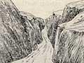
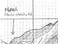
Cotton expanded the ideas of geologist Alexander McKay. In 1886 McKay had suggested that uplift of mountains along fault lines during earthquakes influenced landscape evolution. Cotton realised that the South Island’s Kaikōura ranges had been formed by the splitting and uplifting of blocks of the earth’s crust. From this, he argued that the whole of New Zealand was ‘a concourse of earth blocks’. At the time, the idea that movement along a fault could produce uplifted blocks and mountain ranges was revolutionary. Cotton wrote several papers on the identification of faults in the landscape, describing features such as fault traces, abruptly blocked valleys, and shutter ridges.
In 1941, two young geologists, Harold Wellman and Dick Willett, identified the huge Alpine Fault that bisects the South Island. Wellman was one of Cotton’s students, and both he and Willett were influenced by Cotton’s ideas.