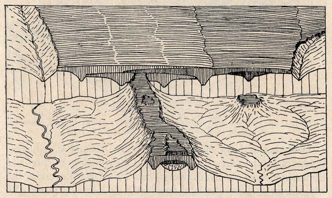
Geologist Charles Cotton often produced composite diagrams showing how a landscape had developed. This two-stage sketch shows a lava plateau (rear) that has been progressively eroded so that there are only remnants of the lava on the tops of hills (front).
Using this item
Te Ara - The Encyclopedia of New Zealand
Reference: Charles Cotton, Geomorphology. Wellington: Whitcombe & Tombs, 1942, fig. 350
by Charles Cotton
This item has been provided for private study purposes (such as school projects, family and local history research) and any published reproduction (print or electronic) may infringe copyright law. It is the responsibility of the user of any material to obtain clearance from the copyright holder.