
Geography as an academic subject
Geography is the study of the land (including geomorphology), and how people live on it. Although widely taught in New Zealand schools, geography was not regarded as a respectable university subject until the mid-20th century. In 1937 George Jobberns was appointed to be the first geography lecturer at Canterbury University College, and by 1950 all the universities were teaching geography.
As taught by Charles Cotton and his contemporaries, geomorphology was the description and classification of landforms. From the 1960s, a younger generation of earth scientists became interested in the processes responsible for landscape evolution, and used new tools to measure rates of change.
Plate tectonics
Emerging in the 1960s was the concept that the earth's crust is made up of about a dozen huge plates of rock. This explained the relationship between many of the earth’s features. New Zealand was found to lie at the junction of the Australian and Pacific plates. Their collision beneath the South Island is now known to have caused the uplift of the Southern Alps and to control the formation of New Zealand’s distinctive landscapes. In the North Island the Pacific Plate is sliding beneath the Australian Plate, producing volcanic activity.
Rainfall and erosion
New Zealand’s rainfall had been recorded for many years, but almost always from low altitudes, where people lived. In the 1970s, measurements taken on the western side of the Southern Alps revealed a 10-kilometre-wide zone of exceptionally heavy rainfall, averaging 11.2 metres per year (equal to the height of a four-storey building).
In this high rainfall zone, the rate of erosion reaches 12 millimetres per year – about the same as the rate of uplift. It is now known that there is a close relationship between plate tectonics, rainfall and erosion. The rapidly uplifting mountains cause the prevailing moist westerly winds to rise and drop much of their moisture on the western side of the main divide. Although the mountains are rising rapidly, they are not getting any higher because the uplift is balanced by erosion.
Giant landslide
The Green Lake landslide, covering more than 45 square kilometres in Fiordland, was discovered by scientist Roger McPherson when scanning aerial photographs. Many of his colleagues were sceptical because no landslide of that size had previously been identified in New Zealand.
Neocatastrophism
In the 1970s the neocatastrophic model of landscape evolution was developed. It stated that, in New Zealand’s dynamic physical environment, infrequent but powerful events such as landslides, floods, volcanoes and earthquakes had as much – if not more – of an impact on landscape evolution as slow, ongoing processes such as uplift and erosion.
Mountain uplift
In 1979 geologist Harold Wellman and his colleagues used a range of evidence, including tilted lake shorelines and uplifted terraces, to estimate the rates at which mountains were rising. The maximum uplift rate of more than 10 millimetres per year was found to occur along the western edge of the Southern Alps. It is one of the fastest rates of mountain uplift in the world.
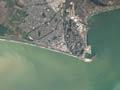
Technological advances
Until the mid-20th century the land was viewed at ground level, with a panorama only possible from a mountainside. The cloud-free aerial photographs of the 1950s revealed previously unknown landforms, and were used to prepare topographic maps. Satellite imagery became available in the 1980s, and is now a key tool for monitoring changes in the landscape and the way land is being used.
Isotope dating techniques have allowed landscape features to be dated with increasing accuracy. Carbon-14 dating, mainly used for dating fragments of wood and charcoal, was the first to be used. A variety of other dating techniques are now available, allowing detailed chronologies of landscape evolution to be developed.