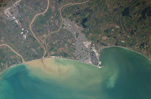
After a period of heavy rain on 12 September 2003, a load of suspended sediment (brown) is carried out to sea off Napier. Satellite imagery like this has revolutionised geomorphology (the description and classification of landforms) because it shows the effects of erosion on land and at sea.
Using this item
NASA - JSC Digital Image Collection
Reference: International Space Station Crew Earth Observations Experiment and the Image Science & Analysis Group, ISS007-E-14844
This item has been provided for private study purposes (such as school projects, family and local history research) and any published reproduction (print or electronic) may infringe copyright law. It is the responsibility of the user of any material to obtain clearance from the copyright holder.