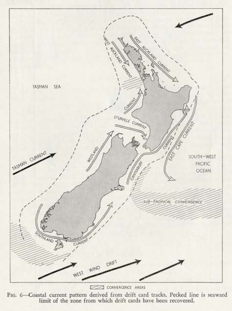
This map, published in 1960, shows the paths of currents around the New Zealand coast as they were understood at that time. The dashed line shows the outer limit of where plastic cards were dropped by researchers into the sea. People picked up the drift cards where they washed ashore and posted them back to the scientists, describing where they were found. From this information a pattern of coastal currents emerged.
Using this item
Te Ara - The Encyclopedia of New Zealand
Reference:
Jim Brodie, 'Coastal surface currents around New Zealand.' New Zealand Journal of Geology and Geophysics 3, no. 2 (May 1960): 249
This item has been provided for private study purposes (such as school projects, family and local history research) and any published reproduction (print or electronic) may infringe copyright law. It is the responsibility of the user of any material to obtain clearance from the copyright holder.


Add new comment