


Formation and growth
When the wind blows over a calm sea, it produces small ripples that grow in size and wavelength (the distance between wave crests). The waves gather speed until they are moving at the same speed as the wind, when equilibrium is reached. However, the height and length of waves, and the period between them, rarely remain constant.
Swell seas
Seafarers have long differentiated between waves that are actively generated by a prevailing storm and those that arrive from a distant storm. A ship in a storm experiences a ‘wind sea’, whereas surfers ride ‘swell’. Waves in a sea show a large range of sizes and directions, while swell tends to be more uniform and regular.
Wave height, length and period
Waves are described in terms of their height, length, period and direction. A wave’s height is measured from the bottom of its trough to the top of its crest. Its length is the distance between successive crests. The period is the time between successive wave crests as they pass by.
Waves in any given sea vary considerably, and oceanographers use the term ‘significant wave height’ as a measure of the characteristic wave size. This is the average of the highest one-third of waves in a sea.
Undone by waves
Waves may have been partly to blame for the demise of New Zealand’s inter-island ferry, the Wahine, during the storm of 10 April 1968. Waves of 12–14 metres and winds blowing to 185 kilometres per hour (100 knots) in the same direction the Wahine was travelling meant that the rudder was useless. The ship veered sharply to port, struck Barrett Reef and subsequently sank.
Wind regions
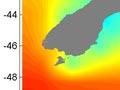
New Zealand lies across two wind zones. To the north, south-east trade winds dominate, although an occasional cyclone will come down from the tropics. The rest of the country is in the path of a broad band of westerly winds that span the middle latitudes of the southern hemisphere – often called the roaring forties. Among the stormiest seas in the world, the roaring forties extend over most of the southern part of the Tasman Sea and the Southern Ocean. This area has some of the world’s largest waves – maximum wave heights regularly exceed 4 metres (by comparison, waves are less than 2 metres high in the subtropics).
Swell generated in the Southern Ocean arrives on the west and south-west of New Zealand. These coasts have the country’s most energetic waves. On the north-east, waves are much smaller because the North and South islands block waves from the south-west.
Measuring waves
The computer models that measure the growth and development of waves are based on wind fields. This data is assembled from a variety of sources, including satellite observations and models of the atmosphere. These models become complex near the coast, when they also need to take into account the effects of bed friction (waves dragging on the sea floor).