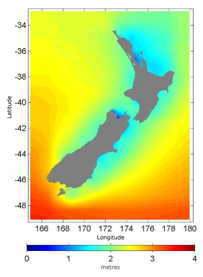
Oceanographers use the term ‘significant wave height’ as a measure of the larger waves in a sea. It is the average measurement of the highest one-third of waves. This map shows the average significant wave height around New Zealand over 20 years. The southern coast generally has the largest waves and the north-eastern coast the smallest.
Using this item
NIWA – National Institute of Water and Atmospheric Research
This item has been provided for private study purposes (such as school projects, family and local history research) and any published reproduction (print or electronic) may infringe copyright law. It is the responsibility of the user of any material to obtain clearance from the copyright holder.


Add new comment