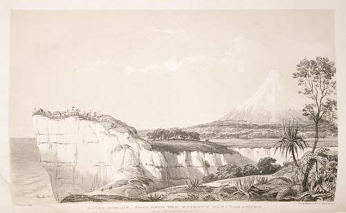
The team contracted to survey the future town of New Plymouth under chief surveyor Frederic Carrington travelled to Taranaki from Wellington in 1840 in two parties, one on the ship Brougham and the other overland along the coast. Charles Heaphy was in the overland party and produced one of the most distinctive early images of the mountain and two of the Māori settlement at Ōtumatua, near Pīhama.
This lithograph from one of his sketches shows Waimate and Ōrangi-tuapeka pā at the mouth of the Kāpuni Stream. Both pā had been destroyed in 1834 by an Australian-based detachment of 50th Regiment troops and Royal Marines during the rescue of members of the Guard family and others taken prisoner by Māori after their vessel Harriet was wrecked off Cape Egmont.
Using this item
Reference: PUBL-0007-131
by Charles Heaphy
Permission of the Alexander Turnbull Library, National Library of New Zealand, Te Puna Mātauranga o Aotearoa, must be obtained before any re-use of this image.