

Story summary
The Kermadec Islands are a group of small volcanic islands, 800–1,000 kilometres north-east of the North Island. A nature reserve, they are uninhabited, except for a Department of Conservation field station on Raoul Island, the main island.
Geology and climate
The Kermadecs are part of a chain of huge undersea volcanoes – the islands are the only part above water. Some of these volcanoes are still active.
The climate is mild and subtropical.
Plants and animals
Distinctive plants and animals – many of them related to New Zealand species – have developed on the Kermadecs.
Raoul Island is the only forested island. Species include the Kermadec pōhutukawa, Kermadec nīkau and māpou. There are large colonies of seabirds, including the red-tailed tropic bird, masked booby and Kermadec parakeet.
Plants and animals introduced by humans have become pests and affected native species. However, goats, cats and rats have been eradicated on Raoul and Macauley islands, and the bird life is increasing.
Human impact
Polynesians visited from the 1300s. In Māori tradition, the Aotea and Kurahaupō canoes visited the Kermadecs, which Māori call Rangitāhua.
In 1793 French explorer Bruni d’Entrecasteaux charted the islands. European whalers landed from the 1790s, leaving live goats to provide meat.
New Zealand annexed the islands in 1887.
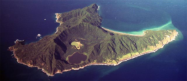
Raoul Island
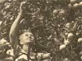
Raoul Island is the largest island at 29 square kilometres. It is part of an underwater volcano, and its calderas have erupted several times since the early 1800s – most recently in 2006. A few families settled there from the 1830s, but left after an eruption in 1870. Thomas Bell and his family lived on the island for 35 years from 1878. From the 1930s attempts were made to grow fruit for export, but they failed because the island lacks a safe harbour.
Southern islands
Macauley and Curtis islands are south-west of Raoul Island. Their small size, difficult access and lack of fresh water has deterred human settlement. The New Zealand government set up castaway depots in the late 19th century.