
Story: Bay of Plenty places

Matakana Island

Image
Matakana Island

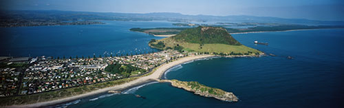
Visible in the distance is the long coastline of Matakana Island, which forms the sand barrier between Tauranga Harbour and the South Pacific Ocean. Mt Maunganui is in the centre of the photograph.

Using this item

GNS Science

Reference: CN30755

by Lloyd Homer

Permission of GNS Science must be obtained before any use of this image.

All images & media in this story

How to cite this page

Malcolm McKinnon, Bay of Plenty places – Tauranga hinterland and harbour, Te Ara – the Encyclopedia of New Zealand, https://teara.govt.nz/en/photograph/5691/matakana-island (accessed 4 June 2026).

Story by Malcolm McKinnon, published 2 March 2009, updated 1 July 2015.